RouteBuddy 4.2 for Windows Review (Also available on Mac OS X)
There’s something delightfully tangible about an OS map. Whether it’s the paper version with disintegrating, tattered fold lines and your pen marks from 9 years ago on a long forgotten possibility or the newer laminated versions, safe in all weather. And let’s face, we’re all still pursuing the dream and personal life goal of mastering the OS map fold . . .
The purists and die hards, myself included, will always swear by our old friend but the OS map is a dying tool. It’s a little cumbersome, awkward, non-too durable unless you have the laminated version and when those isobars tighten up a little atop a remote Scottish mountain, it’s like trying to browse yesterday’s newspaper whilst some annoying idiot grabs both sides and shakes it. I’ll always use them because I’m a little old school and I’ll take something tangible over electronic but we all know times are easier and more user friendly now.
I believe even the humble GPS is fighting a losing battle. Before long our mobiles will do everything for us in the outdoors; take photos, produce video, give us a bearing, offer some reading material for a cold night in and cook our spag bol. OK, the last one is perhaps a way off.
And so enter the plethora of companies offering us mapping software for our phones and pc’s. RouteBuddy has been around a while and after listening to user feedback and incorporating solutions to meet them, subsequent tweaks and improvements now give us a reliable and very effective system. It also won first prize at the 2012 TGO Awards in the clothing and innovation category. Plan your routes on the big screen, download them to your mobile. Lost in the hills? Open the RouteBuddy app and immediately see exactly where you are. If you want to meet the good old OS map half way then you can print too, who’d have thought a few years ago? This latest version, 4.2, was released a few weeks ago.
I’ve been playing around with the system for a couple of months now and despite one minor niggle, I love it. I’m not a big route planner as such, I prefer to pick an area and get some sort of rough idea of where I’m going so using RB on my PC screen to arrange walks is not a huge priority but I have used it. If my navigation is a little rusty I sometimes like to print of a map of a local area and I’ll head out to play with that and a compass. The Smartphone app is genius and I’ve had plenty of time to muck around with that.
I’m not a genius on a pc, I get by but if things get beyond me I hold my hands up and move on. The last thing this review will involve is an in depth user guide, I’ll give you the basics and you can make up your own mind. The RB system took a little getting used to (as you’d expect with anything new on a pc) but I picked it up pretty easy. With my limited experience in mapping (I have just 2 local region mapping systems from other companies which I l have long since given up on) believe me, it doesn’t take long. I played around for a little and found any answers in one of the ‘Help’, ‘Forum’, ‘Store’, or ‘Support’ areas from the drop down menu up top.
Installation of RB itself was trouble free and followed the instructions as I’d expect. I also installed GB 1:50,000 mapping which, with my limited technological expertise perhaps took longer than it should have but again, believe me if I can do it, you’ll breeze it. There were reports of problems with the loading of maps in previous versions but it has been addressed and is trouble free in this version The iPhone app installation was easy This version also has wireless WiFi C2C sync between iPhone and pc.
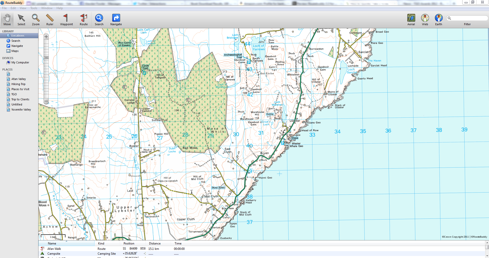
Main Screen
All the options, actions and tools are on this main screen from the drop down menu at the top. The most used controls are displayed above left and consist of MOVE, SELECT, ZOOM, RULER, WAYPOINT, ROUTE, SEARCH and NAVIGATE.
Clicking on the WEB button (top right) will take you to Google maps (Or Bing, Yahoo and other options). I didn’t fully understand why I would need this when I was viewing all the details I needed on the 1:50,000 map except that they maybe some elements on the Google map not on RB like a new road etc and to compare detailing on different maps. RB tell me this is purely to compare and source more info from different maps.
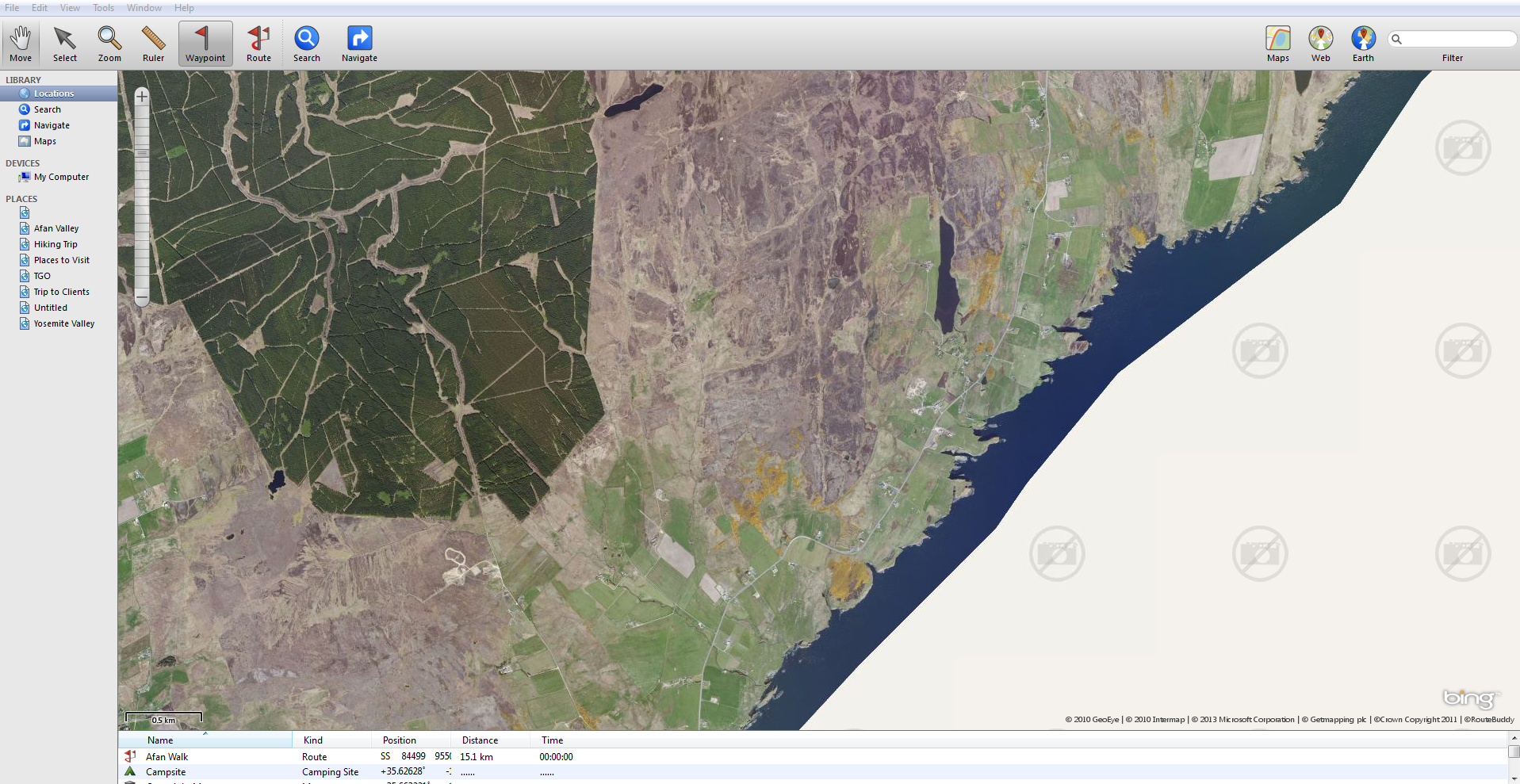
The MAP button can be toggled to change to AERIEL which renders the screen as a satellite shot. This is handy as rendered maps, as accurate as they are, do sometimes miss out details. A track not marked on the map may be visible on the AERIEL shot or little details that can only be seen on an actual photo. Also, to me at least, an actual photograph of terrain, as opposed to a OS or similar map means I can relate to the area more.
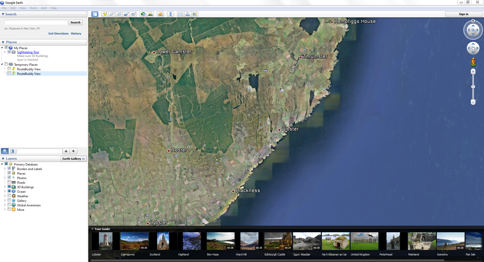
The EARTH option takes you to Google Earth with the benefit of more details and all the information options that come with Google Earth.
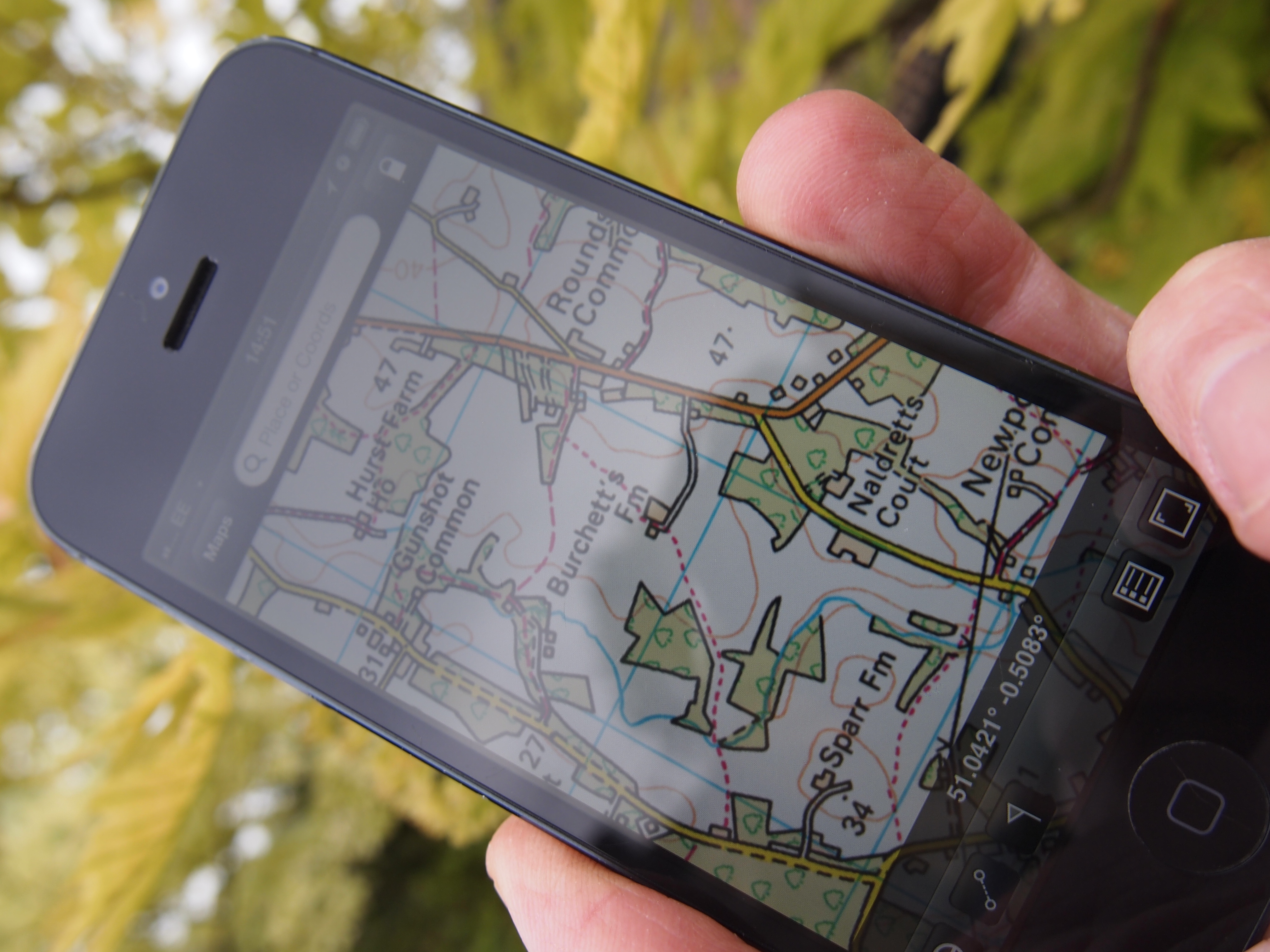
Smartphone Interface
Perhaps the main reason why I opted for mapping software is the ability to carry the entire GB map on my phone. Not only can I download routes I have planned on my pc but if I am lost the app will pinpoint my location with the press of a button to centre my position on the screen. If I’m suddenly in the middle of a white out or forced to walk in the dark it could literally save your life, you know exactly where you are and therefore can take action to get where you want to be. My only grumble is the map orientation is a little confusing because it, well, doesn’t orientate. For example, open Google maps on your Smartphone and rotate yourself around, see how the screen adapts and positions itself so that it is facing wherever you are facing? Well, RB does it differently in that instead of the map facing wherever you are, a little pointer indicates your direction while the maps stays the same. It took a while to get used to and I have it now but I’d prefer to see the map facing where I am, it makes things far easier. The first thing my instructor taught me years ago on a navigation course was to orientate my map. RB tell me that OS, Harvey and USGS maps don’t lend themselves to automatic orientation and after a while, I did get used to it.
The beauty of the application is that I can view an actual OS map (as opposed to a Google map etc). An OS map is what I have become accustomed to using in the outdoors and is what I am used to seeing before me. I understand the symbols, the track and road markings etc. Route Buddy now have around 800 OS maps for you to download.

All in all it’s a sweet system. The good old OS map is still with us and long may it continue but for ease of usability, value for money (see the RB website for full pricing of maps etc), convenience and a glitch free system it’s up at the top of the tree.
Full Details: www.routebuddy.com
RouteBuddy Digital Mapping Software for Windows and Mac OS X – £39.99
RouteBuddy Atlas – Mapping Software for iPhone, iPad and iPod Touch – Free
You can buy the extensive range of maps from RB’s store including:
- Tom Tom Road Maps for North America, Europe and individual countries and groups of countries therein.
- Harvey British Mountain Maps
- Over 600 Ordnance Survey Digital Map titles (Great Britain)
- Over 300 IGN France Digital Map titles
- USGS Digital Topo Maps for 48 States
